Billa Surgam Caves
Bengaluru → Anantapur → Gooty → Dhone → Billa Surgam Caves. ~345 km, a limestone gorge and caves with an Ice Age past.
Billa Surgam is a partly unroofed limestone cave system in the Erramala hills near Betamcherla, in Andhra Pradesh's Nandyal district (formerly Kurnool). The roof collapsed in places and left a meandering gorge about 250 m long with three natural rock bridges across it. This is most likely the canyon-like scene in the reel. Robert Bruce Foote excavated the caves in 1884 and found Pleistocene animal bones and Upper Palaeolithic tools. Getting there is a long NH 44 run across the Deccan plateau, with rough kutcha roads at the end.
Route idea: @nomad_sarva on Instagram
The route
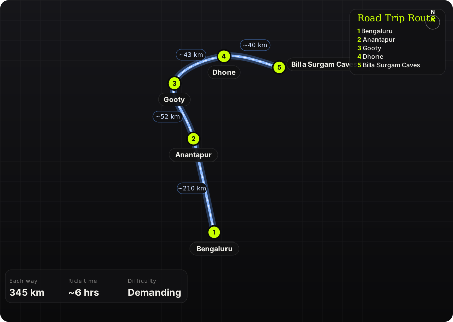
Schematic map generated from waypoint coordinates — the shape follows the geography (compressed so long legs don't squash the loop), distances are labelled per leg. Not a navigation map. Download the graphic.
Leg by leg
| # | Leg | Dist | Notes |
|---|---|---|---|
| 1 | Bengaluru → Anantapur NH 44 | 210 km | Long, straight four-lane highway north past Chikkaballapur and Penukonda onto the dry Anantapur plateau. tarmac |
| 2 | Anantapur → Gooty NH 44 | 52 km | More fast highway, with Gooty's hill fort showing on the right as you near town. tarmac |
| 3 | Gooty → Dhone NH 44 | 43 km | Highway to Dhone, the last good fuel and food stop before the caves. tarmac |
| 4 | Dhone → Billa Surgam Caves Dhone–Betamcherla road + village track | 40 km | About 36 km east to Betamcherla, then a few km of kutcha road towards K.K. Kottala and the caves. mixed |
Highlights
- A meandering, partly unroofed limestone gorge spanned by natural rock bridges
- Named chambers such as the Cathedral, Chapter House and Purgatory, explored since Foote's 1884 excavations
- One of South India's most important Upper Palaeolithic sites
- Easy to combine with Belum Caves or Yaganti, also in Nandyal district, on the second day
Off-road & motorcycling notes
Highway nearly all the way. The approach roads from Betamcherla and Palkuru are reported as kutcha tracks.
- The last few km are unpaved and can rut badly after rain.
- On a road bike, ride the final stretch slowly or park at the village and walk.
- Upgrades to the access road have been proposed, so conditions may have changed.
Timings, permits & fuel
- About 6 hrs each way from Bengaluru with fuel and food stops
- Stay overnight in Dhone, Betamcherla or Kurnool and ride back on day 2
- Reported opening hours are 10:30 am – 6 pm with a ~₹50 ticket. Check locally before relying on this.
Cautions
- Plateau heat is fierce from March to May. Start at dawn and carry plenty of water.
- The site is remote with few facilities. Fuel up in Dhone.
- The caves are dark and uneven inside, so bring a torch and sturdy shoes
- This is a protected archaeological site: don't remove or disturb anything
Sources & further reading
- Billa Surgam – Grotto Map
- Just 280 km from Hyderabad lie Billasurgam Caves older than time – Siasat
- All About Millenia-Old Billasurgam Caves – Outlook Traveller
- Billasurgam caves expected to get facelift – Hyderabad First
- Dhone – Wikipedia
- Bangalore to Bethamcherla – EaseMyTrip
- Billa Surgam Caves guide – Unstumbled