Gudibande Fort
Bengaluru → Devanahalli → Chikkaballapur → Gudibande. ~95 km, a 17th-century hill fort with 19 rock-cut rainwater tanks.
Gudibande Fort crowns a conical granite hill above a small town and lake in Chikkaballapur district. It was built in the 17th century by the local chieftain Byre Gowda, remembered as a Robin Hood who robbed the rich to help the poor. Around 400 broad stone steps climb through gateways and seven levels of walls past a chain of linked rock ponds to the Rameshwara temple on top. The ride is almost all on smooth NH 44, with a short run on district roads at the end.
Route idea: @twoofusonwheels on Instagram
The route
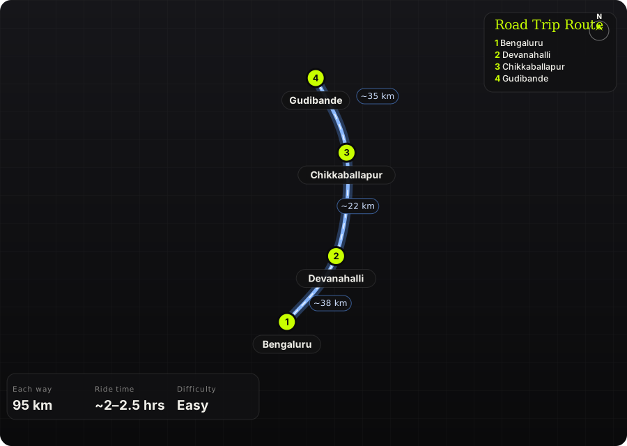
Schematic map generated from waypoint coordinates — the shape follows the geography (compressed so long legs don't squash the loop), distances are labelled per leg. Not a navigation map. Download the graphic.
Leg by leg
| # | Leg | Dist | Notes |
|---|---|---|---|
| 1 | Bengaluru → Devanahalli NH 44 (Bellary Road / airport road) | 38 km | City exit and the fast airport highway to Devanahalli. tarmac |
| 2 | Devanahalli → Chikkaballapur NH 44 | 22 km | Four-lane highway past the Nandi Hills turn-off to Chikkaballapur. tarmac |
| 3 | Chikkaballapur → Gudibande NH 44, then district road to Gudibande | 35 km | More highway north, then a left onto quieter district roads through farmland to Gudibande town and its lake; narrow lanes lead to the foot of the hill. tarmac |
Highlights
- 17th-century hill fort of Byre Gowda, the local 'Robin Hood'
- 19 rock ponds and tanks ('dhones') linked so overflow fed the next, holding ~3 lakh litres
- Seven levels of walls, gateways and sentry posts on the way up
- Rameshwara (Shiva) temple at the summit, said to hold one of the 108 Jyotirlingas
- Views over Gudibande Lake and the plains to Varlakonda
Off-road & motorcycling notes
Paved all the way to the base of the hill; the climb is on foot.
- Last stretch is narrow town lanes to the foothill — park near the base
- Above the steps there is a short scramble over rock to the top
Timings, permits & fuel
- No formal entry fee or permit reported; at most a nominal local fee
- ~400 stone steps, ~45 minutes to the top at an easy pace
- Leave Bengaluru by ~6–7 am to climb before the heat
- Fuel and food are on NH 44 and in Chikkaballapur; carry water for the climb
Cautions
- Exposed rock near the top is slippery when wet — avoid in heavy rain
- Little shade on the hill; carry water and sun cover
- Stray dogs reported around the town lanes
Sources & further reading
- Gudibande (Wikipedia)
- Gudibande: Fort with a rainwater harvesting system built by 'Robin Hood' (30 Stades)
- Gudibande Fort Trek (Backpackers United)
- Journeys across Karnataka: Gudibande Fort
- Bangalore to Vatadahosahalli Lake and Gudibande Fort (Revolving Compass)
- Bengaluru to Gudibande (Rome2Rio)
- Latitude and longitude of Gudibanda